Back Sant Celoni AN صنطلونة Arabic Sant Celoni AST سانت سلنی AZB Sant Celoni Catalan Сан-Селони CE Sant Celoni (munisipyo) CEB Sant Celoni German Sant Celoni DIQ Sant Celoni Esperanto
Sant Celoni | |
|---|---|
 View of Sant Celoni with the Montseny Massif in the background | |
| Coordinates: 41°41′24″N 2°29′24″E / 41.69000°N 2.49000°E | |
| Country | |
| Community | |
| Province | Barcelona |
| Comarca | Vallès Oriental |
| Government | |
| • Mayor | Francesc Deulofeu Fontanillas (2015)[1] (CIU) |
| Area | |
• Total | 65.2 km2 (25.2 sq mi) |
| Elevation | 152 m (499 ft) |
| Population (2018)[3] | |
• Total | 17,754 |
| • Density | 270/km2 (710/sq mi) |
| Demonym(s) | Celoní, celonina |
| Website | santceloni |

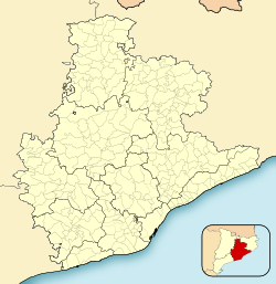
Sant Celoni (Catalan pronunciation: [ˈsan səˈlɔni]) is a municipality in the comarca of the Vallès Oriental in Catalonia, Spain. It is situated in the valley of the Tordera river between the ranges of Montseny and Montnegre. The main part of the town is on the left bank of the river. The former municipalities of Montnegre and Olzinelles now form part of the municipality of sant Celoni, which has the largest area in the comarca. The municipality is served by the AP-7 Motorway and the C-251 road, as well as by a station on the RENFE railway line between Barcelona and Girona.
- ^ "Ajuntament de Sant Celoni". Generalitat of Catalonia. Retrieved 2015-11-13.
- ^ "El municipi en xifres: Sant Celoni". Statistical Institute of Catalonia. Retrieved 2015-11-23.
- ^ Municipal Register of Spain 2018. National Statistics Institute.


